
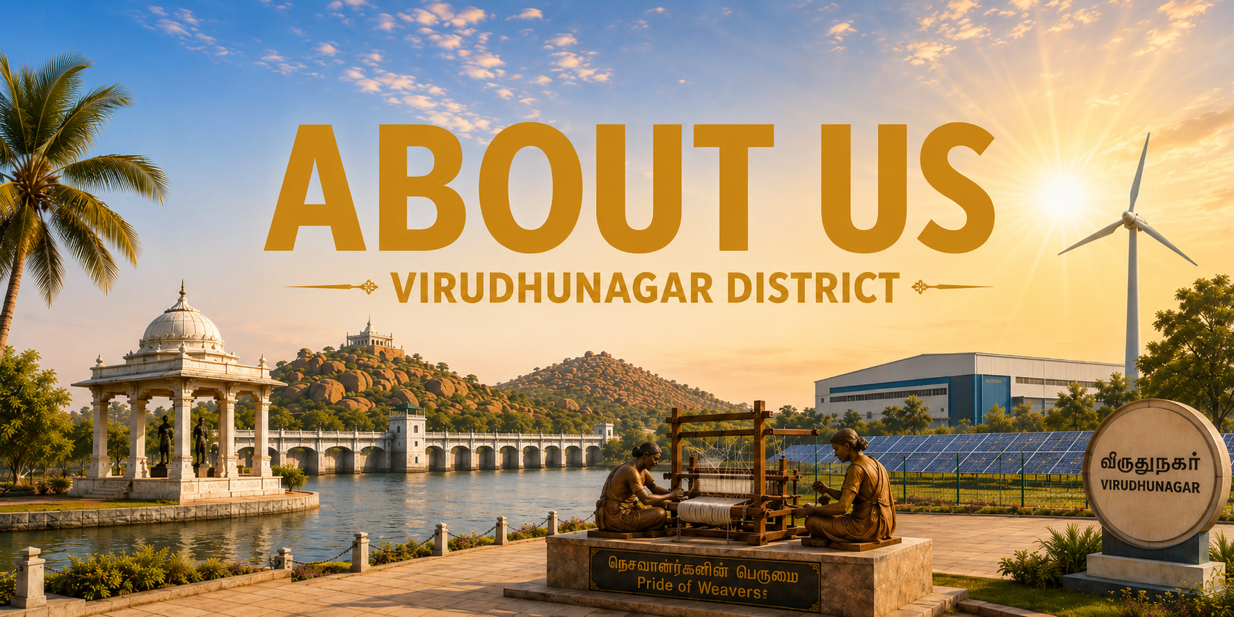

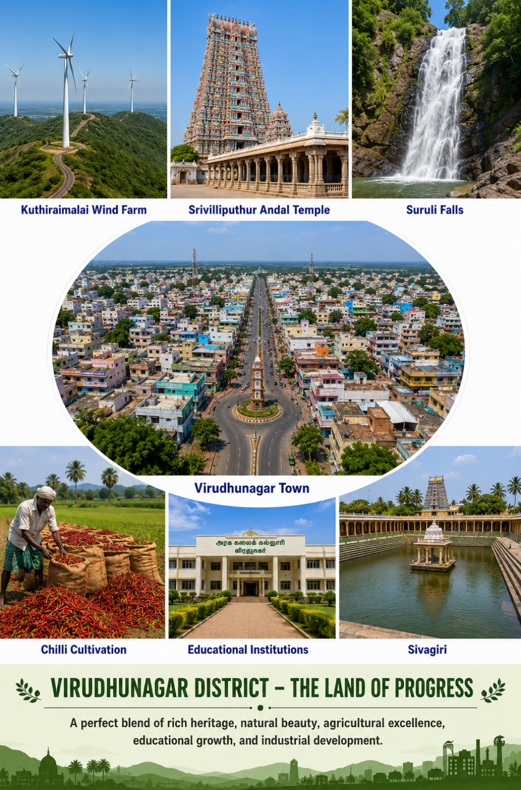

Virudhunagar District stands as a remarkable symbol of progress, culture, and resilience in southern Tamil Nadu. The district beautifully combines its rich historical heritage, spiritual traditions, natural landscapes, agricultural strength, educational growth, and industrial development. Its towns and villages showcase a harmonious blend of traditional values and modern aspirations.
The district is renowned for its agricultural activities, particularly chilli cultivation, which plays an important role in the local economy. The fertile agricultural regions support the cultivation of various crops and provide livelihoods for a large number of farming communities. Alongside agriculture, Virudhunagar has developed into an important centre for trade, commerce, manufacturing, and small-scale industries, contributing significantly to the economic growth of the region.
Virudhunagar is also blessed with several important temples and heritage destinations. The magnificent Srivilliputhur Andal Temple stands as one of the district’s most celebrated landmarks and reflects the architectural and spiritual heritage of Tamil Nadu. Natural attractions such as Suruli Falls add to the district’s scenic beauty, while places such as Sivagiri highlight its cultural and historical character.
Education and knowledge are another important part of the district’s development. Schools, colleges, and educational institutions across Virudhunagar provide opportunities for students and support the growth of young talent. The district is steadily progressing in areas such as skill development and employment.
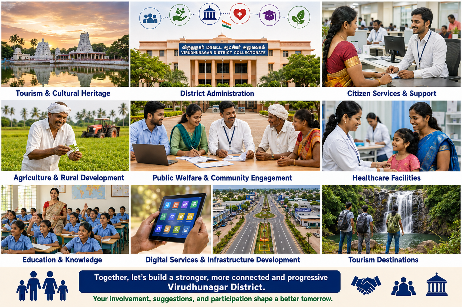
Virudhunagar District is moving forward with a strong focus on citizen welfare, education, healthcare, agriculture, infrastructure, digital services, and tourism. The district administration works to provide accessible public services while supporting the development.
With its rich cultural heritage, natural attractions, agricultural strength, and growing infrastructure, Virudhunagar continues to create new opportunities for its people. Active citizen participation, community cooperation, strengthen development.
The district encourages innovation, skill development, employment opportunities, and sustainable growth for people of all age groups.
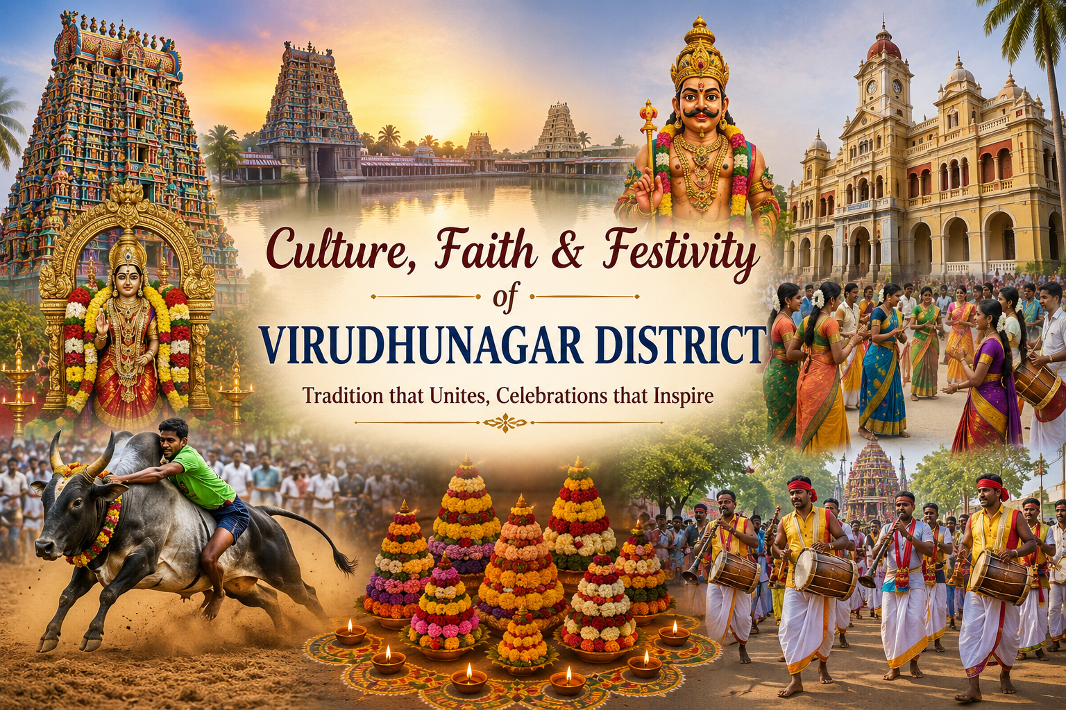
Virudhunagar District is a vibrant land where culture, faith, tradition, and celebration come together. Its magnificent temples, colourful festivals, traditional music, folk performances, and community gatherings reflect the district’s rich cultural heritage.
Festivals such as Pongal, Tamil New Year, temple festivals, and local celebrations bring people together with joy and devotion. Traditional activities, decorated temples, flower arrangements, processions, music, and dance add colour and energy to these occasions.
The district’s spiritual landmarks and historic temples stand as symbols of its deep-rooted traditions.
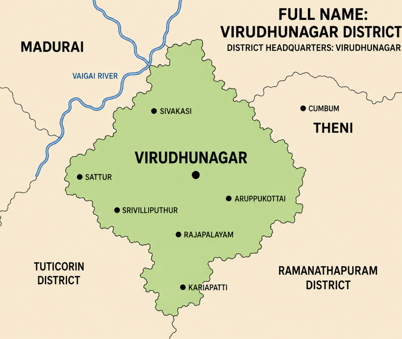
Virudhunagar District is one of the prominent districts in southern Tamil Nadu, strategically located between several important districts of the state. Virudhunagar town is the district headquarters, serving as an important administrative and commercial centre. As shown in the map, the district shares its boundaries with Madurai District in the north, Theni District in the northeast, Ramanathapuram District in the east and southeast, and Thoothukudi District in the south and southwest. The Vaigai River is shown towards the northern side of the district, highlighting its geographical connection with the surrounding region.
The district includes several important towns and urban centres such as Sivakasi, Sattur, Aruppukottai, Srivilliputhur, Rajapalayam and Kariapatti.Each of these towns contributes to the district’s economic and social development.
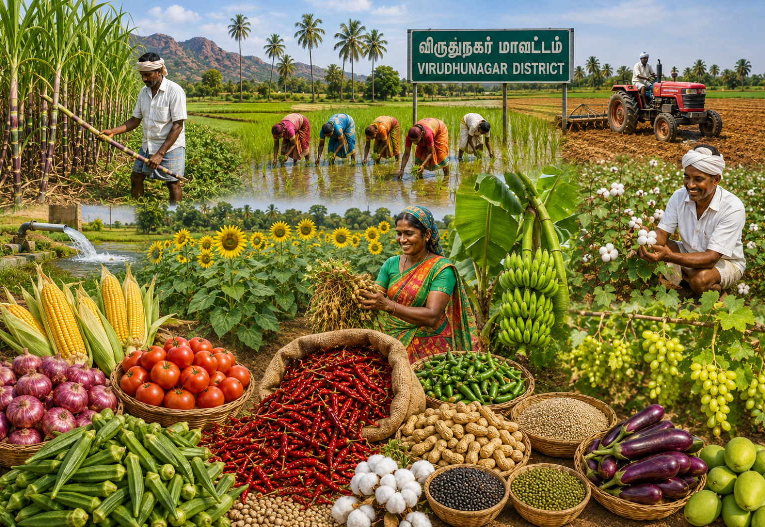
Agriculture is an important part of Virudhunagar District’s rural economy and livelihood. The district supports the cultivation of diverse crops such as paddy, cotton, chilli, maize, groundnut, pulses, banana, vegetables and fruits. The image highlights the hard work of farmers, along with the use of irrigation facilities and modern farm machinery.
Chilli and cotton are among the important commercial crops, while vegetable and horticultural cultivation contributes to local markets and farmer incomes. Efficient water management, modern farming techniques, quality seeds and better market facilities can further strengthen the agricultural sector. With continued support for farmers and sustainable farming.
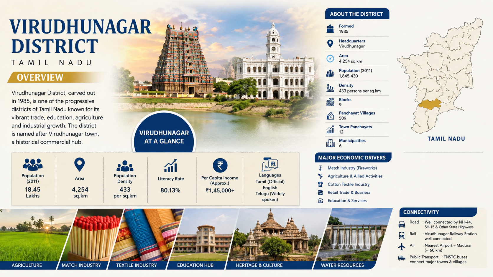
Virudhunagar District, formed in 1985, is an important and progressive district in southern Tamil Nadu, with Virudhunagar town as its administrative headquarters. Covering an area of approximately 4,254 sq. km, the district had a population of about 18.45 lakh according to the 2011 Census, with a population density of around 433 persons per sq. km. The district is known for its strong combination of industrial activity, agriculture, trade, education and cultural heritage.
The district has a diversified economy, with the fireworks and match industries of Sivakasi playing a major role in employment and commerce. Cotton textiles, agriculture, retail trade and service-sector activities further contribute to the local economy. Agricultural activities include the cultivation of paddy, cotton, chilli, pulses, maize, groundnut, vegetables and fruits, supporting a large rural population and associated businesses.
Virudhunagar is also an important education and service centre, with schools, colleges and other institutions serving communities across the district. Its rich cultural heritage is reflected in historic temples and landmarks, particularly in places such as Srivilliputhur, Sivakasi and other historic towns. The district’s temples, traditional festivals and cultural practices attract visitors and strengthen its connection with Tamil Nadu’s heritage.
The district benefits from road and railway connectivity, linking major towns and villages with other parts of Tamil Nadu. National and State Highways provide important road connections, while Virudhunagar Railway Station serves as a significant rail link. Madurai Airport, located about 60 km away, provides the nearest major air connectivity.
With its combination of agriculture, manufacturing, textiles, commerce, education, heritage and infrastructure, Virudhunagar District continues to play an important role in the economic and social development of southern Tamil Nadu.
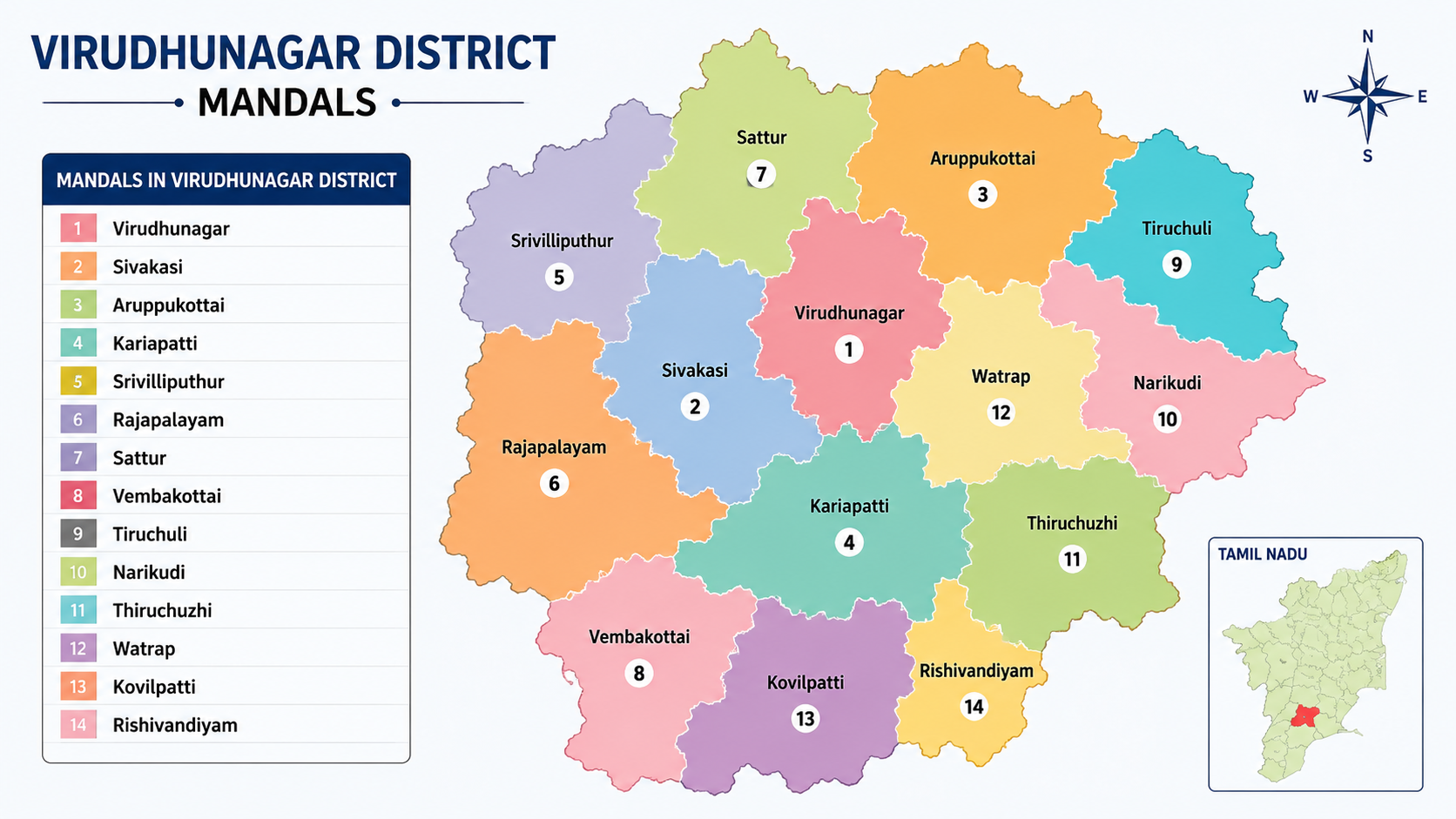
Virudhunagar District is administratively divided into 14 mandals, each playing an important role in local governance and regional development. The mandals shown in the map are Virudhunagar, Sivakasi, Aruppukottai, Kariapatti, Srivilliputhur, Rajapalayam, Sattur, Vembakottai, Tiruchuli, Narikudi, Thiruchuzhi, Watrap, Kovilpatti and Rishivandiyam. These administrative divisions help in the effective delivery of government services, implementation of development programmes and management of rural and urban areas. The mandals together cover diverse agricultural&industrial.
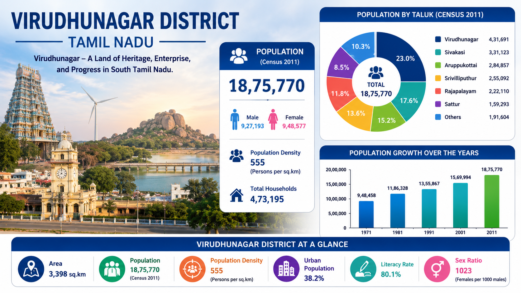
Virudhunagar District, located in southern Tamil Nadu, had a total population of 18,75,770 according to the 2011 Census, comprising 9,27,193 males and 9,48,577 females. The district recorded a population density of 555 persons per sq. km and had approximately 4,73,195 households. The population is distributed across major taluks including Virudhunagar, Sivakasi, Aruppukottai, Srivilliputhur, Rajapalayam and Sattur, along with other areas.The district has experienced steady population growth over the decades, increasing from 9,48,458 in 1971 to 18,75,770 in 2011.
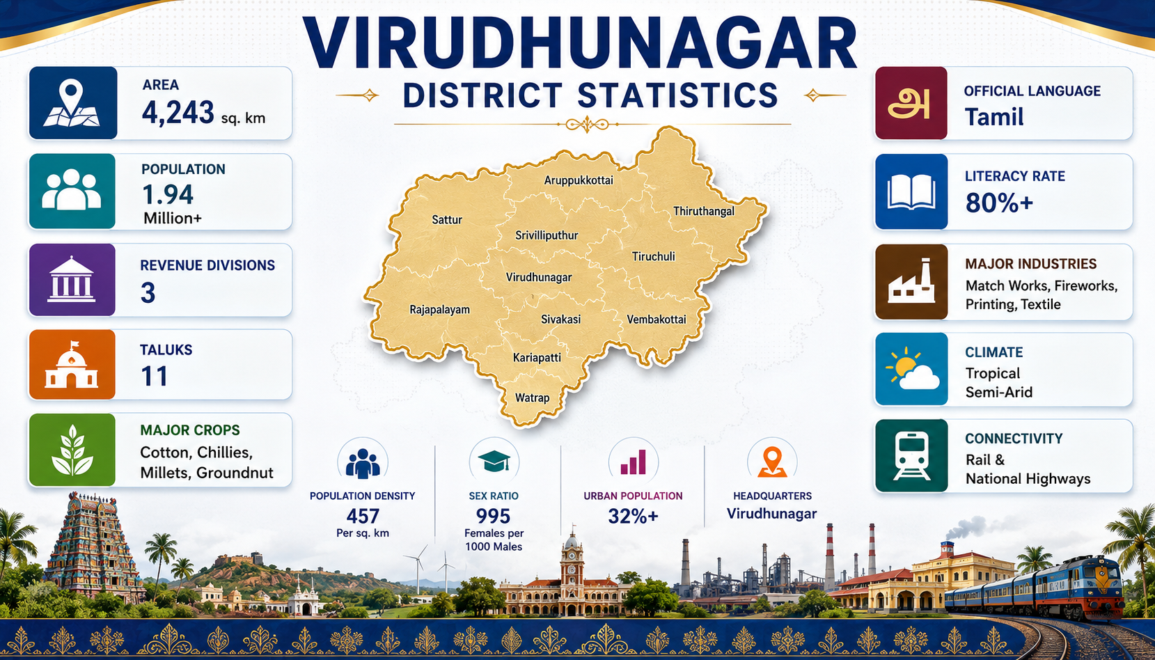
Virudhunagar District is an important district in southern Tamil Nadu, with Virudhunagar as its headquarters. The district covers an area of approximately 4,243 sq. km and has a population of more than 1.94 million. It has 3 revenue divisions and 11 taluks, with a population density of around 457 persons per sq. km. Tamil is the official language, and the district has a literacy rate of over 80%.Agriculture is an important part of the district’s economy, with cotton, chillies, millets and groundnut among the major crops. Virudhunagar is also recognised for its diverse industrial base.
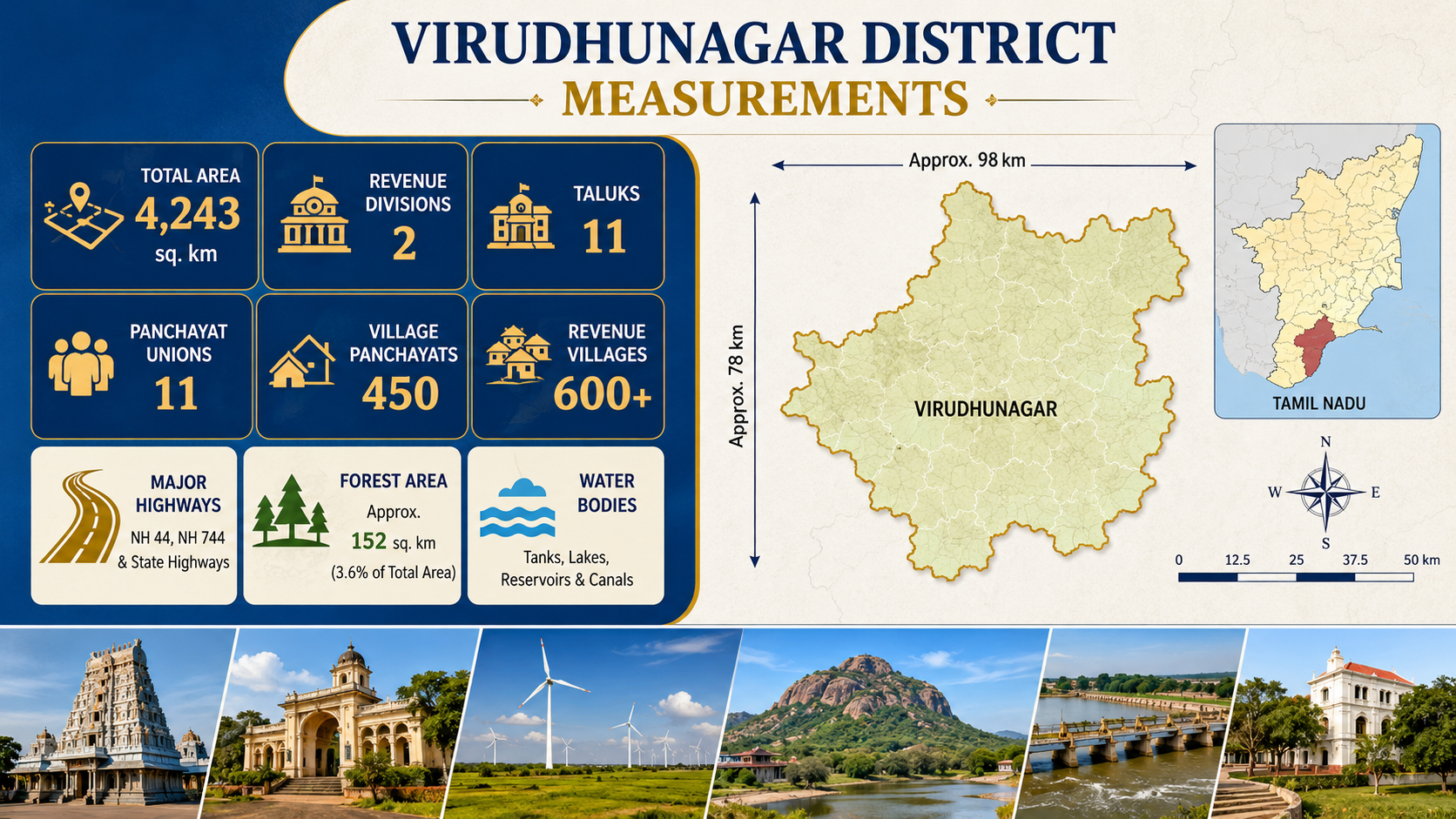
Virudhunagar District covers a total area of approximately 4,243 sq. km and extends about 98 km from east to west and 78 km from north to south. The district is administratively divided into 2 revenue divisions and 11 taluks, with 11 Panchayat Unions, 450 Village Panchayats, and more than 600 revenue villages. The district has approximately 152 sq. km of forest area, accounting for about 3.6% of its total area. Its major road network includes NH 44, NH 744, and several State Highways, providing important connectivity within and beyond the district.
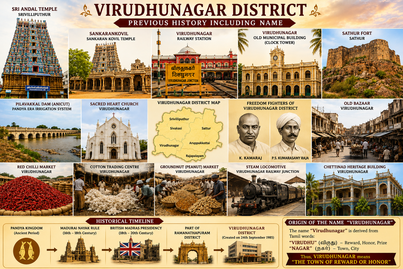
Virudhunagar District has a rich historical and cultural heritage shaped by the Pandya Kingdom, Madurai Nayak rule, British administration, and its later development as a separate district. The region is associated with important landmarks such as Srivilliputhur Andal Temple, Sankarankovil Sankaranar Kovil Temple, Virudhunagar Railway Junction, the old Virudhunagar municipal building and Sattur Fort. Historical irrigation works such as Pilavakkal Dam (Anicut) reflect the region’s long connection with agriculture and water management. Virudhunagar developed as an important commercial centre.
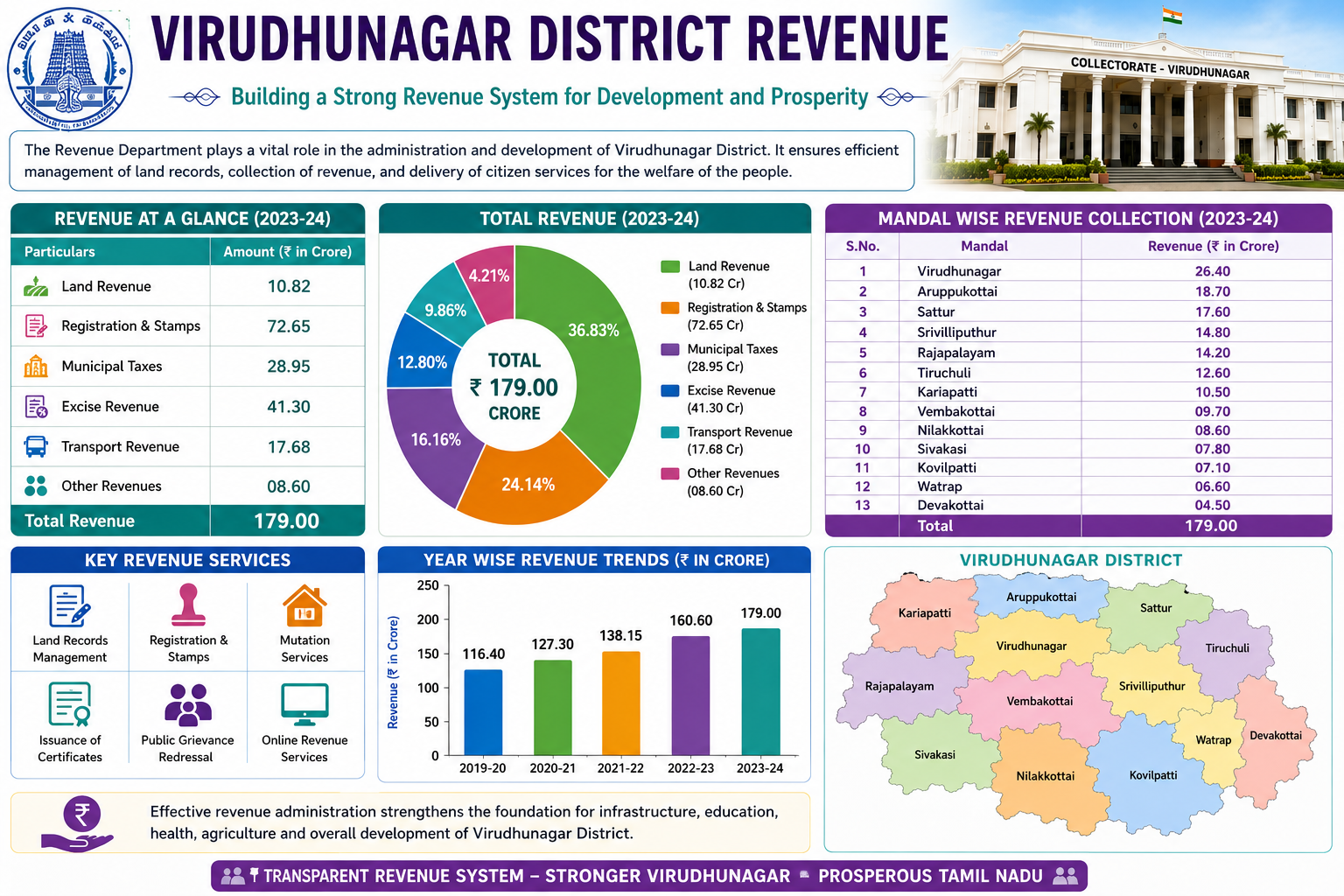
The Revenue Department plays a vital role in the administration and development of Virudhunagar District by managing land records, collecting government revenue, and providing essential citizen services. According to the image, the district recorded a total revenue of ₹179.00 crore in 2023–24, comprising ₹10.82 crore from land revenue, ₹72.65 crore from registration and stamps, ₹28.95 crore from municipal taxes, ₹41.30 crore from excise revenue, ₹17.68 crore from transport revenue, and ₹8.60 crore from other revenues. The revenue collection is distributed across 13 mandals, with Virudhunagar.
Virudhunagar District is located in the southern part of Tamil Nadu, India. It is surrounded by districts including Madurai, Sivaganga, Ramanathapuram, Thoothukudi, Tenkasi and Theni.
Virudhunagar is the administrative headquarters of the district.
Virudhunagar is well known for its fireworks and match industries, printing, textiles, agriculture, temples, and traditional food.
Some popular local foods include Virudhunagar Parotta, Poricha Parotta, Kothu Parotta, Vattu Parotta, and Srivilliputhur Palkova.
The Srivilliputhur Andal Temple is one of the most famous temples in the district and is dedicated to Goddess Andal and Lord Ranganatha.